Saturday, August 1: The flight out.
After the usual flights and drives, we all assembled
at Mammoth Lakes in the evening.
Sunday, August 2: Gaylor Lakes
With a reasonably large group, some of whom haven't backpacked
before, it's good to give people time to adjust to the altitude. We
headed to the Tioga Pass entrance to Yosemite, and took the easy hike
up to the Gaylor Lakes basin, We climbed the first mile
over a low pass to Gaylor Lake, then continued to the Granite Lakes
in a slightly higher basin and up to an area with abandoned silver
mines, the shafts now closed off and the buildings reduced to a few
walls and foundations. The weather was beautiful, apart from a powerful
wind that nearly blew us off our lookout points over the lakes. Cotter,
the youngest of the group, was thrilled to find that there were several
snowfields along our route, and of course a snowball fight was soon
underway.
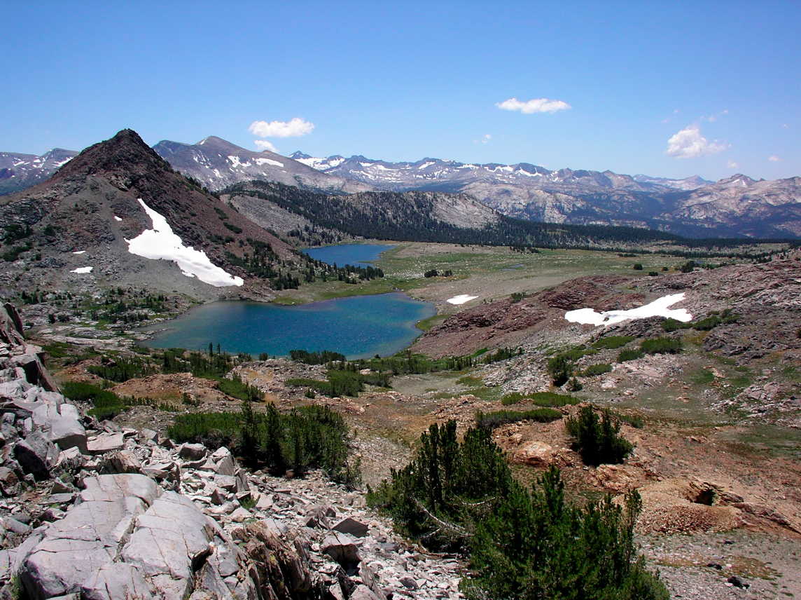
Upper
and Middle Gaylor Lakes (Ed Van Beek)
We stopped—of course!—at the junction of Tioga Pass Road
and Highway 395 to have lunch at Whoa Nellie Deli, the fabulous little
gourmet fast-food restaurant tucked inconspicuously into the Mobil
station. Several people had the famous fish tacos, but this time I
opted for crab taquitos, which were equally delicious (though the mango
salsa was still partly frozen—an unexpected lapse). And of course
we washed it down with a local ale on tap. Not your typical gas-station
fare.
Monday, August 3: Purple Lake
We reported to the Mammoth Lakes
Pack Station at 7 a.m.
and left our backpacks to be carried by mule up to our first destination
at Purple Lake, a ways past Duck Pass. It took more than an hour
to get things organized and then to find the trailhead parking lot
a few miles away, but we were on the trail, very lightly burdened,
shortly after 8 and made our way past a chain of several lakes from
the upper end of Lake Mary to Duck Pass, an ascent of about 2000 feet.
It was a strenuous hike, but on a well-maintained
and well-graded trail. We reached the pass sooner than we had anticipated,
with immediate rewards in the form of magnificent views both back down
the valley we had been in and forward to Duck Lake, one of the largest
lakes in this area.
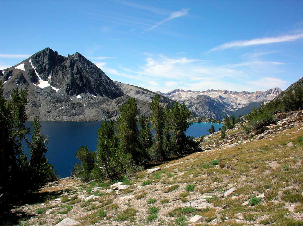
Duck
Lake (Ed Van Beek)
It was about 6 miles to the pass, and the remaining three on the other
side looked much easier on the map but involved lots of ups and downs.
For most of the day Cotter was scampering ahead and then doubling back
to rejoin his dad and the rest of the party, and the rest of us kept
to whatever pace was comfortable: Jane and Kate tend to move along
pretty quickly but take time to rest, Ed is slow on uphill sections
but quick on downhills while I am just the reverse, except that I tend
to fall far behind when there’s anything interesting to photograph,
which there usually is. Deb keeps a moderate and steady pace but often
gets to meeting points first because she never wants to rest for more
than a minute except when we are taking a scheduled break. And Randy
usually brings up the rear, hiking slowly but steadily. It’s
a terrific group to spend a week with, with diverse interests and lots
of topics for conversation.
When we reached Purple Lake, which at 9900 feet is about 900 feet below
the pass, we found that the packers had piled all our gear in the middle
of just about the only campsite that could accommodate half a dozen
tents, with water close by in a lovely rushing stream but not much
of a view of the lake. We all got to the campsite by about 1:30 and
had a relaxing afternoon here. We are in a rather thin forest—the
tree line is not much above 10,000 feet here—and lots of sun
gets through. Clouds moved in during the afternoon, unexpectedly, but
brought no rain, and by evening the sky was clear again.
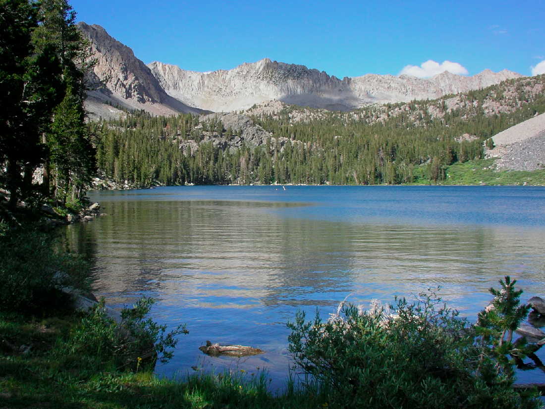
Purple Lake (David Hoekema)
There’s more of a crowd here than we anticipated, however.
A little farther up the trail from the lake is a Boy Scout troop, and
three Australians—mom, dad and 25-year-old daughter—are
camped below us, a few nights into their Tuolumne-to-Whitney hike of
the John Muir Trail. There are two college-age brothers from Binghamton
in another wooded campsite, a young couple camped near the lake, and
another party whom we haven’t seen but continually hear: they
are camped with a couple of dogs who periodically set up a wild hunting
cry as if they have some animal trapped in a tree. Not quite the solitude
we were hoping for! But none of the other campsites is visible from
ours.
We set our dinner hour very early—5 p.m.—and built a campfire
soon afterward. The Binghamton brothers, the older of them (early 20s
or so) an intense sort of environmental mystic, came over to our campfire
after dark—he’s as talkative as his brother is taciturn.
But we were all in our tents preparing to sleep by 9. All except Ed,
for two reasons: first, he never sleeps more than 5 hours, and likes
to stay up and tend the campfire well into the night. Second, he has
no tent but is sleeping under the stars.
Two mishaps marred the day—one minor and quickly resolved, the
other more worrisome. First, when we arrived at the campsite we discovered
that someone had mistakenly tossed Randy’s duffel bag, with all
the gear he did not want to take on the trail, onto the pile of packs
for the mules to carry up to our campsite. Fortunately, a Forest Service
pack team came by very shortly afterward (we sent Katie, as our youngest
and fleetest of foot, to flag them down, since they were following
the main trail well below our campsite—she came back completely
exhausted but said they would look for us in an hour when they were
headed back to the trailhead). They agreed to carry the bag down to
the Mammoth Lakes ranger station. No one has confessed, by the way,
to having taken the duffel from the trunk and placed it with all the
backpacks. Maybe the mules went over and grabbed it in their mouths.
The second mishap happened to Doug while he was washing up in the lake:
he slipped while standing in the water, and a sharp rock put a rather
deep cut into the side of his foot. He’s treated it with antibiotic
cream and closed it up with butterfly bandages, but he’s probably
going to rest tomorrow and then decide whether to continue with us
or hike back out.
Tuesday, August 4 – Still
at Purple Lake
What a joy it is to wake up with the sun—even though we do not
get any direct sunlight in this valley til an hour or two after dawn—and
hear the creek rushing past and the breeze in the pine trees! But we
need to bundle up when we crawl out of our sleeping bags: the temperature
dropped from about 60 yesterday afternoon to the high 30’s overnight.
(Later mornings were even colder, but we never saw any ice in our water
bottles.) Ed came equipped with a coffee percolator, a welcome upgrade
from instant coffee.
After more discussion this morning, Doug decided to head back out right
away with Cotter rather than stay another day here. Randy accompanied
them as far as the Duck Lake, saving Doug the work of carrying his
pack for that stretch. He said he wasn’t experiencing much pain,
even when walking, but he wants to get to a med center today to have
the wound looked at.
The remaining five of us undertook the strenuous day hike that Randy
had suggested, mostly off-trail: up the valley behind Purple Lake to
the Ram Lakes, about 500 feet higher, and then through some lovely
alpine meadows with a little more scrambling up rocky slopes to the
chain of Franklin Lakes a few hundred feet higher. At the beginning
we were following a faint use trail, but that gave out quickly and
we made our own way from one lake to the next, following the cascades
of water that showed us where to climb next. We had to cross a few
rockfalls, and at one point we squeezed through a narrow canyon with
water underfoot and steep rock faces on each side. But it was never
long til we were rewarded with a new view of the valleys and the mountains
above. Each lake, backed by steep granite faces and talus slopes with
snowfields, was a new delight, and the meadows were bright with paintbrush,
heather, columbine (in several varieties—white, yellow, pink,
red), monk’s hood, several varieties of lupine, and many other
flowers. (As is my custom I’ve come home with gorgeous photos
of many of the wildflowers I saw; and as usual I’ve forgotten
just which ones they are, and I don’t have a good reference book
at hand here. “Pretty mountain flowers” doesn’t get
me much credit with real wildflower aficionados.)
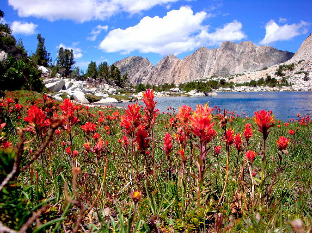
A lake above Purple (David Hoekema)
It took about four hours to reach the highest system of lakes, where
we sat down and ate our lunches. Then we studied the map to figure
out how to reach the next valley to the south and return by a different
route. We scrambled up the lakeside slopes in the right general direction,
and twice we thought we had found the route we were seeking, only to
realize after checking the map and compass that we were looking down
on another section of the Ram Lakes basin that we had not seen on
our way up. Finally we clambered over yet another ridge—we were
now up at about 11,000 feet—and were greeted by a magnificent
panorama down a valley we knew we had not seen before, with the huge
expanse of Virginia Lake far below.
For the most part it was an easy descent, though there was a strong
wind in our faces that sometimes stung our eyes with dust. We kept
to the right side of the valley, since we wanted to avoid descending
all the way to the main trail and then climbing back up to Purple Lake.
About half a mile from the point where we thought the trail must lie,
we set out to bushwhack over a ridge that, we hoped, would give us
access to Purple Lake. The climb was long, rough, and very hot, and
we couldn’t identify any landmarks to confirm that we were really
on track. Moreover—I persuaded Ed after we studied the map again—the
contours on the south side of Purple Lake showed that going cross-country
all the way to the lake’s edge would be impossible without ropes.
So we decided to drop down to the trail, which was a bit of an ordeal,
sliding and slipping down a steep gravelly slope. Even after we reached
the trail we had a hot and dusty mile or so of descent to the lake.
The campsite was a welcome sight after seven hours’ strenuous
off-trail hiking.
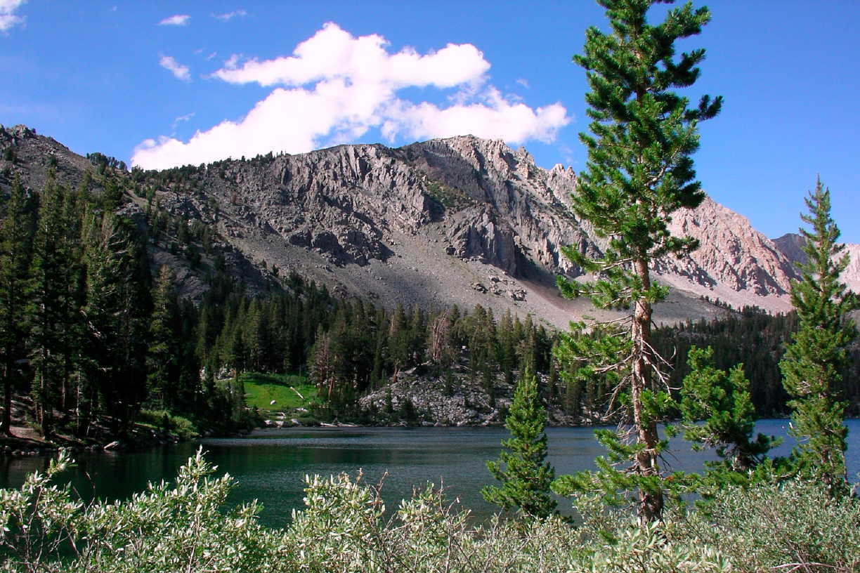
Looking
toward our Purple Lake campsite (Ed Van Beek)
We have no way of knowing just how far we hiked, but it was probably
no more than 8 or 9 miles—for much the day we weren’t covering
more than a mile an hour. Randy was waiting for us, and he hadn’t
started to worry yet since it was only about 4.
Dinner isn’t really a very communal event on a backpacking trip—Randy’s
attempt to organize devotions before dinner doesn’t seem to be
working out. (But my suggestion on the first morning—following
the custom we always followed on our bus outings in Ghana—that
we stand together and join in a word of prayer for the day each morning
when we set out was received with enthusiasm and seems to be taking
the place of anything formal at dinnertime.) We’re sharing four
stoves among eight of us, and generally we start water heating up on
several and keep refilling til everyone has what he or she needs. The
result is that we each sit down and eat out of our individual foil
pouch when the food is ready, except Jane and Kate, and Doug and Cotter,
who brought some meals to share. Still, we are usually all hanging
around the stoves and the campfire area from dinner time til we retire
for the night, reviewing the day’s activities and planning the
next day’s, or taking up other topics of conversation that range
from health care reform to Calvin’s budget challenges to worthwhile
films we’ve seen. Tonight I don’t remember what we were
discussing, but it kept us up really late—I think most of us
stayed up til 9:30! And we tend to be up and about as soon as it’s
fully light at 6 or 6:30. In effect we’ve living somewhere between
Eastern and Pacific time, I guess.
Wednesday, August 5: Skelton Lake
We’ve abandoned our ambitious plan to hike south to Tully Hole
and on to camp at Horse Heaven, then take our last two days to cross
12,000-foot McGee Pass. Randy decided this morning that this was another
of his overly ambitious January fantasies, when he forgets that he’s
not 30 anymore. Slogging up 3000 feet of elevation, two-thirds of it
above tree line and completely exposed to the sun, with full packs
just doesn’t sound like his idea of fun now that he’s in
the realm of reality and not fantasy. I’m a little disappointed—there’s
nothing quite like cresting a really high saddle to make you feel like
you’ve really accomplished something!—but nobody else is
lobbying for the original plan, so I didn’t either. And I suspect
my confidence about doing it would have lasted, say, for the first
1000 feet of the ascent. Weather is a factor too: we had a very windy
night, and when I woke up this morning there was a fine film of grit
on everything inside and outside my tent. It looks as if there may
be some heavy weather on the way. Add to this the unexpected crowds
on this section of our route—which is along a section where the
John Muir Trail has joined the Pacific Crest Trail, after all—and
we have numerous reasons not to continue along the trail heading south.
So we broke camp this morning and retraced our steps over Duck Pass,
this time with all our gear, and tomorrow we will return to Mammoth
Lakes and pick a new trailhead for the remainder of our trip. Rangers
whom we met on the trail said the forecast is for some rain today and
tomorrow, with snow above 10,000 feet. Clouds kept coming and going
all morning as we hiked—offering some welcome relief from the
sun’s intensity when we were above tree line. I was glad to have
a chance to follow the trail alongside Duck Lake again, which is on
a north slope ablaze with wildflowers. That stretch, with the lake
glistening in the sun below, is as pretty a stretch of trail as I’ve
seen anywhere in the mountains. And I kept dropping behind the others
to lie on my belly searching for the right angle from which to capture
the beauty of the flowers.
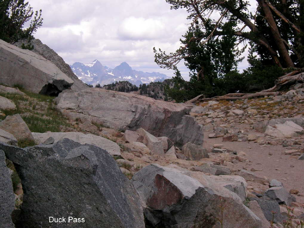
Duck Pass, with Ritter
and Banner (Ed Van Beek)
I didn’t see that the others had stopped at the
pass for lunch, however, and mistook a party far ahead of me for our
group, thinking I’d fallen back even farther than I realized.
So I hurried down the trail to our agreed meeting point at the first
access to Skelton Lake and then got very worried because no one was
there—I thought
the others must have found the camping options poor and gone farther
down the valley. So I decided to wait for Randy at the meeting point.
Better two of us bringing up the rear than just one, I thought, and
we could camp together if we didn’t find the others. About half
an hour later, the rest of the group except Randy caught up with me!
It was someone else’s bright orange shirt that I had seen far
ahead of me coming down from the pass, not Ed’s. Soon we located
a spectacular campsite here with beautiful views of the lake on three
sides. As I write, the water is sparkling in the sunlight while fluffy
white clouds whiz past overhead. We arrived at the site by about 2:30,
and tomorrow morning we expect to be back at our cars in an hour or
two.
Descending, I find, is easier on the hips and quads and heart but harder
on the knees and feet, and on our first day of fully loaded hiking
my feet have taken quite a beating. And if we thought it was crowded
at Purple Lake that was nothing compared to the trail today: I think
we met no fewer than fifty hikers today, mostly on this side of the
pass. They included day hikers, fishermen, through hikers pounding
out the miles, and one or two families in sneakers whose emergency
kit consisted solely of one water bottle to share among four of them.
Four or five parties are camped here at Skelton Lake. But the campsites
are widely scattered, and we only catch an occasional glimpse of a
tent, or after dark a campfire, from our side of the lake. In fact
we’re surprised
that this isn’t a much more popular camping spot, since it’s
so easily accessible.
Thursday, August 6: Davis Lake #2
It’s just past noon and I’m sitting on a log beside Davis
Lake, looking over the lightly rippling water and listening to the
sound of a waterfall a mile or more distant across the lake. (Yesterday
I could never have heard that sound above the howling wind, and the
lake would have been covered in angry little whitecaps.) The waterfall
drops perhaps 80 feet from the top of a granite face, then hits a rockfall
at the bottom and breaks up. I think it may be the source of the stream
right beside our campsite at Davis Lake #2, the next lake up the watershed
on this side of the ridge that separates Hilton Creek and its chain
of 6 lakes from Rock Creek and the large lake that it feeds, which
is accessible by road. The trailhead from which we began yesterday
is just past Rock Creek Lake, and the first part of our trail before
we entered the forested part of the slope gave us a broad view of it
and the valley below.
When we set out from Skelton Lake on Thursday morning we thought we
had an hour or two of hiking, but we were back at our cars in no more
than 45 minutes. Back in Mammoth Lakes, we linked up with a rather
surprised Doug and Cotter and learned that Doug got medical attention,
but no stitches, for his cut, which was healing properly but slowly.
Cotter loves bouldering, and they had visited several sites around
the valley where he could hone his skills. We converged on Kittredge’s,
an outfitter in the town, to buy more gas canisters and other needed
supplies—including warm hats and gloves for those of us who
chad decided to defy the weather forecast and hike back in Thursday
afternoon. The plan was to drive south and head into the Davis Lakes
area. However, there were only seven slots available for the day's
quota for wilderness permits. Five of our group, hearing the forecast
for rain and cold and wind and snow in the upper elevations, decided
it would be a good day to find a motel, get a shower, and wait for
the better weather predicted for Friday. But Ed, Deb, and I decided
we had not come to the mountains just to lollygag around in a motel
room. We reorganized our gear (Ed borrowed Randy’s
tent for protection against the weather), fueled ourselves with a Carl’s
Jr. burger, and set out for the Hilton Lakes trailhead, which we reached
by driving 18 miles south along highway 395 to the barely discernible
town of Tom’s
Place, then another ten miles or so west and south up a valley to the
end of the road, back into the mountains a few days’ hike to
the south and east from our previous campsites. (The McGee Creek trailhead,
where we would have ended up on Saturday under the original plan, is
about halfway between Tom’s Place and Mammoth Lakes.)
Today’s hike both began and ended at 9800 feet, which gave us
the impression, together with the widely spaced contour lines on the
topo map, that it would be an easy stroll. Wrong! It was about 4 miles
of climbing, then 2 miles of descending, gaining and losing only about
600 feet but sometimes over pretty rough ground. And the weather did
indeed offer some surprises: right at the moment we started up the
trail it began to snow. It never amounted to more than a thin shower
of – what should I call them? They weren’t snowflakes,
but rather little spheres of snow that looked almost like hailstones,
hollow pellets that landed ever so gently on our arms and heads. The
snow never accumulated on the ground, and it came and went—indeed,
there was a stretch when we were hiking in bright sunlight with snow
falling all around us. I can’t recall any other time when I was
hiking through snow showers but felt very comfortable in a short-sleeve
shirt. We were in mature forest, with tall pines all around—no
views, most of the time, and no sense of where the trail was headed.
But each time we rounded a corner and saw another long ascent our packs
seemed to get heavier. (And they were heavy—see the account of
our supper below.) We never felt a drop of rain, and before long most
of the clouds had blown past and the sky was a brilliant blue again.
There had been only an occasional light breeze while we climbed, but
when we crossed the shallow saddle and began to descent the wind picked
up, and gained strength minute by minute. We all stopped to put on
additional layers, and even then the wind seemed to suck all the warmth
out of us, even through our windbreakers. This wind was not going to
be broken, but it nearly broke us. When we reached Second Lake—Hilton
Lakes #3 through #6 lie higher up the valley to the south--it was blowing
so strongly that we could hardly bear to stand facing upwind. There
were a number of good campsites along the lake’s banks, but in
winds of 30-35 mph we doubted that we would be able to put up our tents,
let alone cook over our stoves or make a campfire. (It’s been
a criterion all week that our camping spots must be below 10,000 feet,
since campfires are prohibited above that level, where trees are sparse
and grow very slowly.)
We continued around the north end of the lake, hoping to find a sheltered
spot, with no success. And we had met nobody else headed in to camp
in our area, or already camped there—because it’s just
less used, or because everyone else had more sense than to defy the
weather forecasts? Deb and I were tired, and feeling a bit discouraged
about reaching our destination but still having no idea where we would
be able to spend the night. My left foot was causing me a lot of pain,
and Ed and Deb went ahead to keep looking for possibilities while I
trailed along behind. Deb looked along the area of the lake outlet,
toward Davis Lake, but found nothing usable. We were getting worried
when 45 minutes had passed and Ed hadn’t returned to report on
what he had found.
When he finally showed up he said he’d made his way around to
the one corner of the lake where the water was relatively calm, not
whipped into a froth, and had found several well-established campsites
there with plenty of level tent sites protected from the wind. But
he had not found any way to get there except by crossing a wide and
very wet bog and then wrestling through dense thickets of brush. We
followed him, and to our immense relief found a splendid spot where
the wind was no more than a brisk breeze. Connecting four campsites
was a clearly identifiable trail—but none connecting that area
with the main trail on the other side of the lake. There must be a
better route than ours, but we never found it.
We had set out at 1:00 and reached Second Lake by 3:30, but it was
well after 5 when we finally set up our tents. It’s a perfectly
lovely site, with lake views, a rushing stream right beside us for
water, and a low ridge to the east that the sun clears by 6:30 in the
morning. The fire pit we found at the site was gigantic, though, and
full of cinders and garbage, completely unsuited for a campfire—it
looked like an altar where you’d sacrifice an ox to Zeus. Ed
set out building a smaller and better-designed one, with protection
from the wind. In the morning Deb and I disassembled the big ugly altar,
scattered the ashes, and rebuilt it as a table for cooking and sitting.
We’ll pack out the metal and glass that we found as we dug out
the cinders.
Around Ed’s new campfire pit we enjoyed a wonderful supper, which
was the reason for our heavy packs: we had packed in bratwurst to roast
on sticks over the fire, good beer in bottles (Ed and I had selected
four bottles each, for our two days—Deb compromised on two 22-oz
cans to save the weight when we pack out), an onion to sautee over
the stove, a jar of good mustard—what a feast! And a wonderful
end to a day that had its anxious moments.
Friday, August 7: Davis Lake #2
This morning Ed and Deb set out to climb the steep slope behind our
camp to the west, hoping for good views from a small summit that we
can see from the lake. I volunteered to guide the rest of our party
by leaving a note and a map at the trail junction half a mile above
our lake intended to cheer the rest of the group on:
I set out along
the lake’s
south shore, hoping that was the easy route we had not found on Thursday.
Not at all! The first half mile was a scramble over rocks and gravel,
with no visible trail to follow but easy enough to negotiate. But then
I came to a large rockfall that was very challenging with just a daypack
and would have been close to impossible with a full backpack. It took
me 45 minutes to pick my way from boulder to boulder and cover no more
than a quarter mile of distance. So when I got to the junction I left
a map and description of yesterday’s route for the others to
follow.
One benefit of my explorations today was finding a patch of Sierra
lilies in glorious bloom, exquisite little yellow spotted trumpets
that we have not seen anywhere else. I think the wildflowers are at
their peak right about now, though a few favorites I’ve seen
on previous trips, like the shooting star, have finished their season
already.
I could easily lie back on the forest floor here and sleep for the
rest of the afternoon in the shade. But I’m going to return to
our camp to see whether the latecomers have found their way there.
Now back to that waterfall I was admiring and listening to on Friday:
in fact it feeds not Second Lake but Davis Lake, through a second feeder
stream not far from the Second Lake outlet. After the five motel-dwelling
softies in our party reached the campsite shortly after noon (following
my map and arriving a little before I did), Ed and Jane and Katie listened
to my account of the waterfall and decided that we should go and find
it. We succeeded, with some tips from a couple of fishermen we met
along the way. It took us no more than half an hour to reach Davis
Lake by following the outlet stream, and then another 20 minutes to
cross over to the other stream and scramble up to the rockfall at the
base of the waterfall. Ed warned the others on our return “Don’t
go on a day hike with Jane and David—you’ll stop to admire
every wildflower you pass.”

Photo: David Hoekema
Friday we were back to freeze-dried meals—the late joiners hadn’t
thought to bring a fresh supply of beer and brats—and we enjoyed
our last evening around a blazing campfire.
Saturday, August 8: Separate Ways
Saturday morning we broke
camp and had our brief devotions (I tried to lead the group in a song,
which was such a disaster that I was glad I hadn’t tried to lead
any campfire songs earlier) and were on our way by 8 am. The return
trip to Hilton Lakes trailhead was a little easier than the outbound
trip, with only a few steep ascents and descents. But carrying a full
pack is still hard work, and for me descending causes more problems
than ascending. We all proceeded at whatever pace was comfortable,
with no group stops, and we were at our cars well before noon.
Then came a stop at Rock Creek Resort—the “Pie in the Sky
Café”—for burgers and slices of delicious (if very
pricey) fruit pies. And showers! Then the other seven headed for Las
Vegas and their midnight departure, following a shorter route across
Death Valley that avoided the winding mountain roads of their trip
to Mammoth Lakes. I headed south back to LA, with a brief stop at a
hot spring I’d read about along Highway 395—ten minutes’ soaking
in water as hot as I could stand felt wonderful after a week of hiking!
So that was the 2009 Bytwerk expedition to the Sierra Nevada: eight
hikers ranging from almost 13 to 59 in age, half male and half female
this time; five or six nights out in the wilderness; about 20 miles
of hiking with our packs and 20-30 more with daypacks, depending on
which excursions each person joined; a score of exquisitely beautiful
Alpine lakes and a million wildflowers; just one injury that proved
not to be very serious. I’m grateful to Randy, who fell in love
with these mountains three decades ago and generously invites the rest
of us to join the excursions that he plans. And feeling renewed, refreshed,
and just a bit tired.
Notes of possible use to those planning a hike
in the area.
1. With a
group of 8, we rented a condo
in Mammoth Lakes for two nights. I'd
recommend it. Much better than a batch of motel rooms.
2.We probably
should have expected it, but Purple Lake can be crowded. A nice lake,
but if you like reasonable privacy, go elsewhere. Also, although
both the Forest Service and packer told us that there had been no
bear reports at Purple for the last several years, the folk at the
next campsite said they saw one. It didn't seem to cause anyone difficulty,
and we were prepared with canisters, but if you go there, know there
might be a bear in the area.
3. The trip to the far side of Lake #2 isn't as bad as
the note suggests. Stay above the shoreline as you work around the
lake. There are two excellent campsites on that side, worth the effort
to reach.
Contact: Randall Bytwerk
(bytw2calvin.edu —
Change the "2"
to a "@")


